Cultural Walk

Ylivieska’s Urban Walk and Cultural Walk take walkers to the most interesting historical stages of the city.

Näkymä Savisillalta jokea pitkin illalla.

Ylivieska’s Urban Walk is a walking route of interesting destinations prepared by Ylivieska Local Heritage Association in 2007. The route has been further developed over the years and has become the Cultural Walk which can be walked independently or with a guide. Guided Cultural walks are part of the cultural services’ summer activities.

Destinations

Click the name of the destination below and further details will be shown.

Google maps

Helaala Mill on Ylivieska cultural services’ Museums page

In the summer, the renovated and refurbished mill operates as a handicrafts shop, Akustiikka’s ticket sales point and a café. The mill is situated at the shore of Kalajoki in the centre of Ylivieska. The mill has been classified as valuable in terms of its history, building history and milieu. Its channel structures and machinery date back to 1884. The mill was damaged in a fire in 1942. The current mill building was built in 1943-44 in accordance with the original log building, and it operated until the 1980s.

The Government issued a protection order on the mill in 1992. The Helaala Mill Foundation was founded in 1999. In 2017, the Helaala Mill Foundation donated the mill to the City of Ylivieska.

Google maps

In 1912, concrete was a relatively unknown building material. Due to its colour, people started calling the bridge Clay Bridge, and the bridge continues to be referred to with this name. There were individuals who suspected the durability of the new building material but the bridge led traffic over Kalajoki until 1971. At the time, the Helaala bridge was built to replace the clay bridge, which had become too busy in terms of traffic, and it remained in pedestrian use.

The Clay Bridge has undergone renovation work in 1928-1932 as well as in the 1980s. The bridge consists of two one-opening reinforced steel beam bridges and two cantilever bridges. Originally, the bridge’s wear surface was gravel and later paving. The Clay Bridge, which has been classed as a museum bridge by the Finnish Road Administration, is Finland’s second oldest concrete bridge.

Google maps

The river banks have been reformed and vegetation suitable for the river landscape has been planted. Trails run on both sides of the river. The trails are called Meijeripolku [Dairy Trail] and Myllypolku [Mill Trail]. Sea buckthorn, currants, loosestrife, cotoneaster, mountain willow, Finnish white rose, Neillia, spiraea and fly honeysuckle grow in the area on the mill side. On the northern shore, you can find, e.g., Vaahterakuja and both alpine and forest clematis trail up the trunks of the maple trees. In addition, currants and spiraea have been planted there. Bird vetch and harebell grow in the flower meadow. The roses are called William Baffin and William’s Double Yellow. At the shore of the Kassinen plot, there are three larches which have chosen to grow there by themselves.

Google maps

Ylivieska congregation’s website

The church burned down in 2016. Ylivieska church was built in 1786.

There are several memorials in the church park:

  • Pietari Päivärinta’s memorial More information here
  • Ylivieska’s hero statue depicting a dying soldier has been designed by sculptor Johannes Haapasalo
  • Memorial for those left in Karelia
  • Memorial of those who sacrificed themselves for their beliefs
  • “Lakeuden liekki” statue

Google maps

In the centre of the park, there is a large residential building which has been built in several stages and its style is similar to a school or mansion. The oldest part of the building dates back to approx. 1830. Its current appearance is from the 1940s.

Google maps

Finland’s only pietism museum used to operate in Jaakola House, situated in the centre of Ylivieska. The museum no longer operates.

Jaakola House on the Kirjastovirma website

Google maps

The region is a nationally important culture-historical environment. In the years 1884-86, a station building built in accordance with class IV station type drawings, residential buildings, outbuildings, root cellars and a water tower were situated in the area. The first train arrived in Ylivieska in 1886.

An air-raid shelter built of stones in the shape of a dome “kivikukko” is located next to the station building. Feriatis, situated next to the railway station, was revealed in 1986 in honour of the 100th anniversary of the railway construction. The monument has been designed by Antonio da Cudan.

Google maps

The locomotive built at the Tampella factory in Tampere in 1939 served our railways until the early 1970s. The freight train’s firebox consumed approximately 4.5 cubic metres of birch logs per hour. The tender could hold logs for approximately three hours and then it was necessary to stop and refill at a suitable station. When transitioning to coal, it became slightly easier; 900 kg per hour was consumed.

Memories of these times include, for example, Ylivieska station’s water tower which was used to refill locomotives. Jumbo no. 943 can be seen in Ylivieska’s locomotive depot’s yard area, alongside Viljavarastontie.

Google maps

A commercial concentration, strongly influencing the city’s current development, where there are lots of specialised shops.

Google maps

Ylivieska Cultural Centre Akustiikka’s website

Regional cultural centre. Art exhibitions, concerts, meeting and training facilities.

Google maps

A park named after Mauno Koivisto. The trail runs along the river bed of Katajaoja. Lots of plants have been planted in the area, and the plants have nameplates. The “first establishment year” of the Arboretum park is 1982. Kyösti Niskanen, who was a gardener for the City of Ylivieska at the time, came up with the idea. He, for example, organised an initiative in which organisations, companies and private individuals were involved in the form of plant donations and gardening volunteering. As a memory of this, some of the very first plants to be planted still exist: Common ash/YSTY, Norway maple/SOKOS Ylivieska, Omorika spruce/ Lions Club Huhmari and Örnas birch/City of Ylivieska.

The actual design has been created by green construction and design engineer Pentti Martikainen in 1985 (as his main thesis while head gardener at the University of Oulu). In his design, there were approximately 490 plant species, including woody plants, domestic herbaceous plants, useful plants and various bulbous plants. However, the design was not implemented to this extent because all the planned plants/species could not simply fit in the park. The park has been renovated in 1993; perennial flower bed (approximately 80 plant species) and in 2000, the area of rock plants (approximately 40 plant species).

Google maps

The Winter War veterans’ memorial located in the Veteran Park was revealed in 1987. The memorial is made of orbicular granite and it has Juhani Aho’s text: “Don’t ask what your country provides you, ask what you can provide it.”

The cannon was revealed in 2007. Cannon memorial in memory of the heavy batteries established in Ylivieska during the war

Google maps

Vehicles, cars, motorcycles, bicycles as well as business equipment and old artefacts.

Google maps

Puuhkala local history museum on Ylivieska cultural services’ Museums page

The museum was established in 1969 by Ylivieska Local Heritage Association which has collected the majority of the museum area’s buildings and artefacts. Nowadays, the museum is managed by the City of Ylivieska. Primarily, Puuhkala is a peasant museum, but the museum also exhibits artefacts from other sectors, such as the handicrafts and service sectors. The museum area consists of 15 buildings and they contain more than 7,000 artefacts. Artefacts continue to be collected. Particularly, the milk jug collection is aimed to be expanded.


More About History of Ylivieska

Culture Walk

Google maps

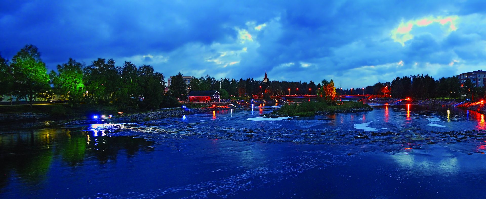
The guided Culture Walk allows people to familiarise themselves in Ylivieska’s most important landmarks and attractions as well as statues. The local heritage path takes you by foot to the attractions in the area of Ylivieska’s city centre. The route starts at Helaala Mill from where the river landscape route is followed to the area of the new church, which is under construction, and the old church ruin, while familiarising in the congregation’s different phases leading up to the dramatic church fire and the construction of a new church.

The route continues to the location of the first folk school, the current Veteran Park, where men leaving for war were convened to wait before heading off to the battlefront. The journey continues to the city hall and library where the history of Ylivieska is reviewed. At the same time, we familiarise ourselves with Päivärinta School and Cultural Centre Akustiikka.

From there, the walk continues via Pikkupappila and Pietari Päivärinta’s residence “Lukkarinpuustelli” towards the railway station where we find out how the railway influenced the development of Ylivieska. We then continue to Jaakola House. The long and colourful history of the house is also directly entwined with the history of Ylivieska through many events. The last destination is Finland’s second concrete bridge, the Clay Bridge, before returning to Helaala Mill. The walk also takes visitors to statue attractions, where we delve into their history and their artists and sculptors.

The Cultural Walk not only provides a piece of history, it also involves the landscapes through the “Changing Ylivieska “ theme and how, over the years, Ylivieska has developed from a market to a central city of the region.

Jaa sosiaalisessa mediassa:
FacebookTwitterShare